These are New Zealand's best and worst swimming spots
- Publish date
- Thursday, 21 Dec 2017, 9:30AM
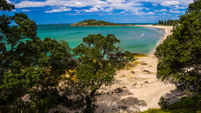
A just-launched index has revealed New Zealand's best and worst swimming spots - with some popular sites listed as no-go zones among almost 700 rivers, lakes, and beaches.
The updated LAWA (Land, Air, Water Aotearoa) website now features an online tool that lets people check on their local spots before they head for a dip.
The project is a partnership between 16 regional councils, the Ministry for the Environment and the Cawthron Institute.
Among around 40 spots currently listed as "unsuitable for swimming" was the pools at the top of Gisborne's famous Rere Rockslide and 10 beach sites in Auckland.
"Caution" classifications had been given to more than 20, including Northland's pohutukawa-lined Coopers Beach, Waihi Beach, Taranaki's Onaero Beach and Acacia Bay at Lake Taupo.
Water quality for swimming was generally classified according to weekly sampling results and the overall bacterial risk based on longer-term sampling.
Anna Madarasz-Smith, a water quality scientist who leads the "Can I swim here?" project, encouraged families to use the tool.
"With the information on 'Can I swim here?' people can swim in our great outdoors with confidence this summer."
One new feature showed toxic algae results for rivers and lakes where this was monitored.
It was the first time this information had been available on a nationwide website.
"Toxic algae has been particularly prevalent in rivers and lakes over the past couple of weeks, due to a warm and dry start to the summer season," Madarasz-Smith said.
"It's important people know what to look for as this poses a health risk, especially for small children and dogs."
The website also featured E. coli results for freshwater sites and enterococci results for beaches.
Most strains of E. coli are harmless, but some could make people sick, cause severe stomach cramps, diarrhoea and vomiting.
LAWA group chair Stephen Woodhead said many council science teams would be working over the summer holiday period to keep people informed.
"Water quality changes; so over summer, council science teams monitor your favourite rivers, lakes, and beaches," he said.
"A handy tip is to save LAWA on to the home screen on your mobile, for instant access to you favourite swimming sites'."
Some councils also provided point-of-entry signs at popular sites, and swimmers should take notice and follow their instructions, he said.
The new section was separate from LAWA's dataset on overall river quality around the country.
This showed that, between 1994 and 2013, nitrate-nitrogen trends were worsening at 61 per cent of and improving at 22 per cent of 175 monitored river sites in pastoral areas, and leaching from agricultural soils was estimated to have increased 29 per cent from 1990 to 2012.
But than 99 per cent of total river length was estimated not to have nitrate-nitrogen concentrations high enough to affect the growth of multiple sensitive freshwater species for the period between 2009 and 13.
Of 268 monitored river sites in the pastoral areas, E.coli trends were "indeterminate" at 65 per cent, improving at 21 per cent, and worsening at 14 per cent of sites for the period between 2004 and 13.
Urban and forested sites had similar results, but there were comparatively few monitored sites among these areas.
Of total river segment length of large rivers, 83 per cent was not expected to have regular or extended algal blooms.
River sites on LAWA generally had worse results than coastal and ocean sites.
No-go zones
NORTHLAND:
Hatea River, Whangarei Falls; Kerikeri River at the Stone Store; Kerikeri River at Rainbow Falls; Tirohanga River at Tirohanga Road;
AUCKLAND: Armour Bay; Christmas Beach; Clarks Beach; Fosters Bay; Green Bay Beach; Judges Bay; Huia Beach; Mellons Bay; Te Atatu Beach; Titirangi Beach
BAY OF PLENTY: Kaiate Stream; Lake Okaro; Whakatane River
GISBORNE/HAWKES BAY: Rere Rockslide (top); Rere Falls; Clive River (at boat ramp); Tukituki River (at Black Bridge, Haumoana)
MANAWATU/WHANGANUI:
Hautapu River (at Papakai Park); Kahuterawa Stream (at Sledge Track)
WELLINGTON:
Akatarawa River (at Hutt confluence); Hutt River (at Birchville, Maoribank Corner, Melling Bridge, Poets Park, and Silverstream Bridge).
CANTERBURY: Ashburton River (at SH1); Avon River (at Kerrs Beach); Kaiapoi River (at boat ramp); Lake Hood (at marina site); Lyell Creek (at lagoon); Pareora River (at Pareora Huts); Selwyn River (at Coes Ford and Upper Huts).
OTAGO/SOUTHLAND: Kakanui River (at Clifton Falls Bridge); Lake Hayes (at Mill Creek shallows); Aparima River (at Thornbury);
Caution
NORTHLAND:
Cooper's Beach; Ngunguru Estuary at school
AUCKLAND: Cornwallis Beach; French Bay; Mulberry Grove; Narrow Neck Beach; Orere Pt Beach; Pah Beach
WAIKATO: Acacia Bay, Lake Taupo
BAY OF PLENTY:
Ngongotaha Stream; Waihi Beach
TARANAKI: Kaupokonui River (at Beach Domain); Manganui River (at Everett Park); Onaero Beach (at surf life saving club); Patea River (at King Edward Park scout den); Timaru Stream (at end of Weld Rd); Waingongoro River (at Eltham Presbyterian Camp)
MANAWATU/WHANGANUI: Hokio Stream (at Muaupoko Street Bridge); Lake Wiritoa; Mowhanau Stream (at footbridge); Ongarue River (Cherry Grove); Hokio Beach
TASMAN/MARLBOROUGH: Taylor River at at Riverside Park
WEST COAST/CANTERBURY: Buller River at Marrs Beach; Kaniere River (at Kaniere-Kokatahi Rd Bridge); Gooches Beach; Waihao River
OTAGO/SOUTHLAND: Taieri River (at Waipata); New River Estuary (at Omaui)
This article was first published on NZ Herald and is republished here with permission.
Take your Radio, Podcasts and Music with you
